
The Grassland and Parkland Natural Regions are two of six Natural Regions found in Alberta. The Natural Regions are defined geographically on the basis of landscape patterns, notably vegetation, soils and physiographic features.

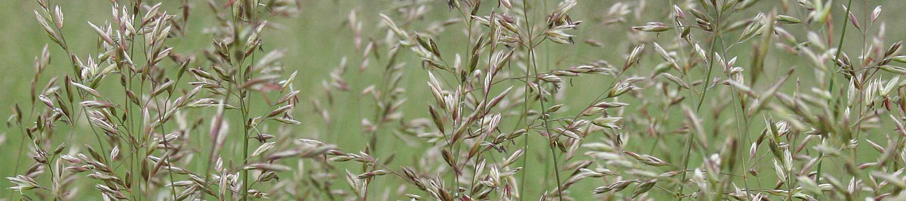
The Grassland Natural Region comprises approximately 30 million acres (14%) of Alberta, extending west to the Rocky Mountains and north to the southern edge of the Parkland Natural Region in central Alberta. The region is a flat-to-gently rolling plain with a few major hill systems. Most of the bedrock is covered with glacial till deposits. Some areas are blanketed by glacial lake sediments, sand dune fields and outwash plains. Badlands have developed where river valleys and their associated coulees and ravines are carved deeply into bedrock, especially along the Red Deer, South Saskatchewan and Milk rivers. The Milk River drainage contains the only exposures of igneous bedrock in the grasslands of western Canada. All other bedrock exposures are of sedimentary rocks.

Alberta’s grasslands are part of the Great Plains that stretch from the Gulf of Mexico, through the United States and into Canada’s prairie provinces.

There are four Natural Subregions within the Grassland Natural Region, each distinguished by differences in climate, soils and vegetation: Dry Mixedgrass, Mixedgrass, Northern Fescue, and Foothills Fescue.

Open The Grassland Natural Region Map as PDF

Click on the coloured areas of the map to learn more…

Area: 3921 km2 or approximately 6% of Parkland Natural Region.

Soils: Black Chernozems are the dominant soils under grasslands and Dark Gray Chernozems occur under forest cover. Orthic Gleysols occur in the wettest, most poorly drained areas.

Vegetation:

  • Similar to the adjacent Foothills Fescue and Montane Natural Subregions.
  • Vegetation can be subdivided into 3 distinct communities:
  1. Mountain rough fescue–bluebunch fescue–needle-and-thread communities vegetate the driest south- and west-facing slopes.
  2. Aspen forests with balsam poplar,white spruce or Douglas fir with understories of snowberry, silverberry, white meadowsweet, prickly rose, saskatoon and a diverse array of forbs occur moist, moderately well drained northerly slopes, seepage zones or low areas.
  3. Willow groveland dominated by a dense beaked willow tall shrub canopy with an understory associates are wild red raspberry, wild white geranium and other forbs on moderately to imperfectly drained sites, found on the western slopes of the Porcupine Hills.

Geography:

  • Rolling to hilly landscapes are typical and occur along the boundary of the Southern Alberta Uplands and the Foothills.
  • Hills are heavily dissected by small intermittent streams.
  • Elevations range from north of Calgary to about 1400 m in the Porcupine Hills; average 1250 m.

Climate:

  • Climatically more similar to the Foothills Fescue and Montane Natural Subregions than it is to the other parkland Natural Subregions.
  • Highest precipitation, warmest winters, and shortest, coolest growing season of any of the parkland Natural Subregions due to proximity to the mountains and a greater incidence of Chinooks.
  • Mean monthly precipitation: 517 mm; peak typically occurs in July as rain.
  • Mean annual temperature: 3°C
  • Mean temperature, warmest month (June-August): 14.7°C
  • Mean temperature, coldest month: – 9.7°C

Human Use:

  • Over 60 percent of the Natural Subregion is used for native or improved rangeland.
  • Oil and gas exploration and development is significant.
  • The Porcupine Hills are a popular hunting and camping destination.

Source: Natural Regions Committee 2006. Natural Regions and Subregions of Alberta. Compiled by D.J. Downing and W.W. Pettapiece. Government of Alberta. Pub. No. T/852.

Area: 53,706 km2 or approximately 88% of Parkland Natural Region.

Soils: Black Chernozems, some Dark Gray Chernozems, significant occurrences of Solonetzic soils.

Vegetation:

  • Vegetation can be subdivided into a southern grassland-dominated portion and a northern aspen-dominated portion due to distinct climate and soil regimes.
  • Aspen clumps are present in the southern portion but restricted to moist sites.
  • Grasslands dominated by Western porcupine grass, June grass, needle-and-thread, blue grama, dryland sedges and pasture sagewort occur in sparsely vegetated communities on dry, rapidly drained soils.
  • Plains rough fescue, slender wheat grass and forb cover increase with better soil moisture conditions.
  • Smooth brome invasion on moist, loamy soils is currently a threat to plains rough fescue communities.
  • Shrub communities include: buckbrush, silverberry, prickly rose, chokecherry and saskatoon on moderately well drained sites; silverberry communities are often found adjacent to saline wetlands.
  • Tree species: balsam poplar is often present with aspen and white spruce on moist, rich sites with lush, diverse understories throughout the Natural Subregion. White spruce can occur in pure stands on moist sites where fire occurrence is infrequent, and are most commonly found on protected locations on coulee slopes.

Geography:

    • The Central Parkland Natural Subregion lies mainly within the Eastern Alberta Plains.
    • The dominant landform is undulating glacial till plains, with about 30 percent as hummocky, rolling and undulating uplands.
    • Elevations range from 500 m near the Alberta–Saskatchewan border to1250 m near Calgary; average 750 m.

Climate:

    • Monthly temperature variations are most similar to those of the Northern Fescue Natural Subregion, with slightly warmer winters and summers than the Dry Mixedwood Natural Subregion.
    • Mean monthly precipitation: 441 mm; peak typically occurs in June and July as rain.
    • Mean annual temperature: 2.3°C
    • Mean temperature, warmest month (June-August): 16.5°C
    • Mean temperature, coldest month: – 9.6°C

Wildlife: The numerous and very productive wetlands in the Central Parkland Natural Subregion are regarded as the “duck factory” of North America.

Human Use:

  • The most densely populated region in Alberta; Edmonton, Red Deer and Calgary all lie wholly or partly within the Central Parkland Natural Subregion.
  • Only about 5 percent of the Central Parkland Natural Subregion remains in native vegetation.
  • The area has been intensively cultivated for over a century, and the few remaining contiguous areas of parkland vegetation occur on sites that are unsuitable for agriculture because of topography or soil constraints.
  • Conventional petroleum exploration and development activities occur throughout. Heavy oil, strip coal mining and gravel extraction activities occur locally.

Source: Natural Regions Committee 2006. Natural Regions and Subregions of Alberta. Compiled by D.J. Downing and W.W. Pettapiece. Government of Alberta. Pub. No. T/852.

Area: 4.7 million ha (~11.6 million acres) or approximately 49% of the total area of the Grasslands Natural Region. This Natural Subregion contains approximately 61% (a number that is disproportionately high) of the Grasslands Natural Region native prairie.

Soils: Predominately Dark Brown Chernozems. Solonetzic soils are found in the southeast part of the natural region where saline conditions occur.

Vegetation:

  • Predominance of both short and mid-height grasses. Mid-grasses found in this Natural Subregion include Stipa spp. (spear grass), Agropyron smithii (western wheat grass) and Koeleria micrantha (June grass) and the short grasses dominated by Bouteloua gracilis (blue grama).
  • Agropyron dasystachyum (northern wheat grass) and Stipa curtiseta (western porcupine grass) are characteristic of moister sites within the Natural Subregion.
  • Solonetzic soils are typically occupied by the Agropyron smithii – Bouteloua gracilis (western wheat grass – blue grama) community.
  • The most widespread vegetation of sand dune areas is dominated by Stipa comata (needle and thread grass), Calamovilfa longifolia (sand grass), Koeleria macrantha (June grass)
  • Common shrubs: Artemisia cana (sagebrush), Elaeagnus commutata (silverberry), Symphoricarpos occidentalis (western snowberry) and Rosa acicularis (prickly rose).

Geography: The predominant landform is a low-relief ground moraine. Elevations range from 600 metres above sea level near Empress to more than 1300 metres on the lower slopes of the Cypress Hills, Sweetgrass Hills and Milk River Ridge (average: 800 m).

Climate:

  • Warmest and driest Natural Subregion in Alberta; characterized by cold winters, warm summers and low precipitation with high year-to-year and within season precipitation and temperature variation.
  • Mean monthly precipitation: 333 mm; peak typically occurs in June as rain; snow cover and the number of days of continuous snow cover are typically low compared to other Natural Subregions.
  • Mean annual temperature:  4°C
  • Mean temperature, warmest month(May – September): 19°C
  • Mean temperature, coldest month: – 12°C

Wildlife: highest diversity of animal species of the four grasslands Natural Subregions. Many species especially those of sand dune areas and the extreme southeast part of Alberta occur nowhere else in the province.

  • Heavily grazed uplands: horned lark, McCrown’s longspur, chestnut-collared longspur and Richardson’s ground squirrel.
  • Species of lightly grazed areas:  Baird’s sparrow, Sprague’s pipit, sharp-tailed grouse and upland sandpiper.
  • Sagebush communities: Sage grouse, lark bunting, Brewer’s sparrow and pronghorn
  • Sandy areas:  Ord’s kangaroo rat and western hognose snake
  • Riparian shrublands and forests:  thrasher, grey catbird, yellow-breasted chat, mourning dove, northern flicker, house wren, northern oriole, deer mouse, Nuttall’s cottontail and white-tailed deer.
  • Rock outcrops and badlands: golden eagle, rock wren, ferruginous hawk, prairie falcon and mountain bluebird
  • Wetlands: boreal chorus frog, northern leopard frog, plains spadefoot toad and garter snake

Human Use:

  • Natural Subregion is made of 66% Crown land (provincially owned), 34% private land. The Natural Subregion has a low population density with Medicine Hat serving as the main service centre.
  • Ranching is the dominate land-use
  • The Natural Subregion also contains significant petroleum and natural gas fields (and the resulting infrastructure such as wellsites and pipelines) and some coal development.
  • The western half of the Natural Subregion has extensive irrigation.
  • Dinosaur and Writing-on-Stone Provincial Parks are considered culturally and historically significant sites.

Source: Natural Regions Committee 2006. Natural Regions and Subregions of Alberta. Compiled by D.J. Downing and W.W. Pettapiece. Government of Alberta. Pub. No. T/852.

Area: 1.4 million ha (3.4 million acres) or approximately 14% of the total area of the Grasslands Natural Region.

Soils: Dark Brown and Black Chernozems

Vegetation:

  • Dominated by Festuca scabrella (rough fescue), F. idahoensis (Idaho fescue), Danthonia parryi (Parry’s oatgrass) and Danthonia californica (intermediate oatgrass)
  • Associated grasses include Koeleria macrantha (June grass), Agropyron dasystachyum (northern wheatgrass), Stipa curtiseta (western porcupine grass), S. columbiana (Columbia needle grass), Poa cusickii (Cusick’s bluegrass) and Helictotrichon hookeri (Hooker’s oat grass).
  • Forbs: Geranium viscosissimum (sticky geranium), Anemone patens (prairie crocus), Lithospermum ruderale (wooly gromwell), Galium boreale, Thermopsis rhombifolia (golden bean), Artemisia ludoviciana (prairie sagewort), Hedysarum alpinum (American sweet vetch), Delphinium bicolor (low larkspur), Ranunculus cardiophyllus (heart-leaved buttercup), Dodecatheon spp. (shooting star), and Lomatium triternatum (western wild parsley). Balsamorhiza sagittata (balsam-root) is characteristic of steep slopes of the foothills portion but is absent in the Cypress Hills.
  • Extensive narrow-leaf cottonwood forests, which are found nowhere else in Canada, occur along the Oldman, Belly, Waterton and St. Mary rivers.

Geography:

  • This Subregion occurs predominately on morainal, glaciolacustrine and outwash deposits along the lower flanks of the Foothills Geologic Belt, the Porcupine Hills and onto the adjacent plains area
  • Rolling to hummocky uplands are typical of the southern and western portions of this Subregion, with undulating plains to the north and east.
  • This is the highest grassland Natural Subregion, with elevations ranging from 800 m in the north near Drumheller to over 1500 m on the east slopes of the Porcupine Hills (average 1100 m).

Climate: Cooler summers and shorter growing seasons, but warmer winters and more precipitation than other grassland Natural Subregions greater frequency of chinooks and thus, a milder winter climate.

  • Mean monthly precipitation: 470 mm; peak typically occurs in May and June as rain.
  • Mean annual temperature:  4°C
  • Mean temperature, warmest month (May – September): 16°C
  • Mean temperature, coldest month: – 10°C

Wildlife: Upland wildlife is most diverse on the Milk River Ridge. Wildlife and shrublands of the southwestern rivers is similar to that of the Milk River in the Mixedgrass Natural Subregion. Along the western edge of the Foothills Fescue Natural Subregion, some Rocky Mountain species occur.

Human Use:

  • Principal and-use is agricultural, most prevalent in the plains (up to 80%) and less so in the hilly uplands (up to 20% cultivation) where grazing predominates.
  • At higher elevations, the growing season is too short for wheat, and barley and forage crops are more commonly grown.
  • Significant oil and gas activity in the foothills, and the Subregion is popular for recreation, especially near Calgary.
  • The Peigan Indian Reserve and a portion of the Blood Indian Reserve are also found within this Subregion.

Source: Natural Regions Committee 2006. Natural Regions and Subregions of Alberta. Compiled by D.J. Downing and W.W. Pettapiece. Government of Alberta. Pub. No. T/852.

Area: 1.5 million ha (3.7 million acres) or approximately 16% of the total area of the Grasslands Natural Region.

Soils: Dark Brown and Black Chernozems, with Brown Solonetz soils extending through the centre of the Subregion in a broad band.

Vegetation:

  • Grasslands dominated by Festuca scabrella (rough fescue), with Koeleria cristata (june grass), Stipa curtiseta (western porcupine grass), Agropyron trachycaulum (slender wheatgrass), and Helictotrichon hookeri (Hooker’s oatgrass) also important.
  • Common forbs include Anemone patens (prairie crocus), Artemisia ludoviciana (prairie sagewort), Cerastium arvense (mouse-ear chickweed), Linum lewisii (wild blue flax), Erigeron glabellus (fleabane), Galium boreale (northern bedstraw), Campanula rotundifolia (harebell) and Geum triflorum (old man’s whiskers).
  • Sand dune areas contain a mixture of Festuca scabrella grasslands with scattered shrubs of Elaeagnus commutata (wolf-willow) or thickets of Rosa spp. and Symphoricarpos occidentalis (western snowberry).

Geography:

  • Characterized by gently rolling terrain.
  • The most common landforms are low-relief ground moraine and hummocky moraine.
  • Elevations range from about 650 m near the Alberta–Saskatchewan border to nearly 1100m on the Hand Hills southeast of Drumheller (average 800m).

Climate:

  • Cooler and moister than the adjacent southerly Mixedgrass and Dry Mixedgrass Natural Subregions; climatically similar to the adjacent Central Parkland Natural Subregion.
  • Mean monthly precipitation: 385 mm; peak typically occurs in June and July as rain.
  • Mean annual temperature:  3°C
  • Mean temperature, warmest month (May – September): 17°C
  • Mean temperature, coldest month: – 14°C

Wildlife: No animal species are restricted to the Northern Fescue Subregion and the composition is similar to that of the Mixedgrass Subregion. Generally, species that favour lightly to moderately grazed Northern Fescue grassland also favour lightly grazed Mixedgrass areas. These include Baird’s sparrow, Sprague’s pipit, upland sandpiper and sharp-tailed grouse. With heavy grazing, species more typical of the Mixedgrass Subregion increase, including horned lark, chestnut-collared longspur and Richardson’s ground squirrel. Species more characteristic of the Northern Fescue Subregion than the Mixedgrass Subregion include savannah sparrow and thirteen-lined ground squirrel.

Human Use:

  • Very productive soils with significant agricultural development (60% cultivated fields and 40% grazed native prairie).
  • Some petroleum and natural gas development.
  • Drumheller is the major service centre for the Subregion.

Source: Natural Regions Committee 2006. Natural Regions and Subregions of Alberta. Compiled by D.J. Downing and W.W. Pettapiece. Government of Alberta. Pub. No. T/852.

Area: 2.0 million ha (5.0million acres) or approximately 21% of the total area of the Grasslands Natural Region. This Natural Subregion contains approximately 14% of the Grasslands Natural Region native prairie.

Soils: Dark Brown. Black Chernozems occur on moister sites along the northern and western boundaries of this Subregion.

Vegetation:

  • The moister, cooler conditions of this Natural Subregion, compared to the Dry Mixedgrass Natural Subregion, are reflected in the greater productivity of rangelands which typically produce 25% more biomass and include a greater abundance of species that favour cooler and moister sites.
  • Dominated by Stipa comata (needle and thread grass) Stipa curtiseta (western porcupine grass) and Agropyron smithii (western wheat grass) and A. dasystachyum (northern wheat grass) that favour mesic site found throughout the region.
  • Fine-textured soils in glacial lake basins are characterized by the Agropyron dasystachyum – Koeleria macrantha (northern wheat grass – June grass) community.
  • On drier, exposed sites Bouteloua gracilis (blue grama) is more common.
  • Typical vegetation of sandy areas includes: Stipa comata (spear grass), Calamovilfa longifolia (sand grass), Koeleria macrantha (June grass) and a variety of low shrubs including Elaeagnus commutata (silverberry), Symphoricarpos occidentalis (western snowberry) and Rosa acicularis (prickly rose).
  • Extensive Populus angustifolia (narrow-leaved cottonwood) woodlands occur on fluvial terraces of the Oldman, Belly, Waterton, and St. Mary’s rivers and nowhere else in Canada.

Geography: The predominant landforms are ground moraine and hummocky moraine. Elevations range from about 650 m near the Red Deer River to about 1450 m on the Cypress Hills (average: 975 m).

Climate:

  • The climate of the Mixedgrass Natural Subregion is slightly moister and cooler than that of the Dry Mixedgrass Natural Subregion.
  • Winter temperatures are 1-2°C warmer than the Dry Mixedgrass Natural Subregion due to greater frequency of chinook days (20-30 days)
  • Mean monthly precipitation: 394 mm; peak typically occurs in June as rain; snow cover and the number of days of continuous snow cover are typically low compared to other Natural Subregions.
  • Mean annual temperature:  4°C
  • Mean temperature, warmest month(May – September): 18°C
  • Mean temperature, coldest month: – 10°C

Wildlife: generally similar to but less diverse than that of the Dry Mixedgrass Natural Natural Subregion. Sandy areas are less common and the proportion of natural habitats is lower due to extensive agricultural development.

Human Use:

  • Most intensively cultivated Subregion in Alberta, with about 85% of the area planted to annual crops both dryland and irrigated (~5%).
  • A large number of livestock feeding operations can be found north of Lethbridge.
  • Oil and gas exploration and development is common throughout.
  • The Subregion also contains the Siksika Indian Reserve and a significant portion of the Blood Indian Reserve.

Source: Natural Regions Committee 2006. Natural Regions and Subregions of Alberta. Compiled by D.J. Downing and W.W. Pettapiece. Government of Alberta. Pub. No. T/852.